Final Year Project · IEEE IBCAST 2026
Floodline
Ranks flooded neighbourhoods so responders know where to go first. Across six floods on four continents, its top 10% of hexagons held 76% of the graded damage.
Aug 2025 – May 2026
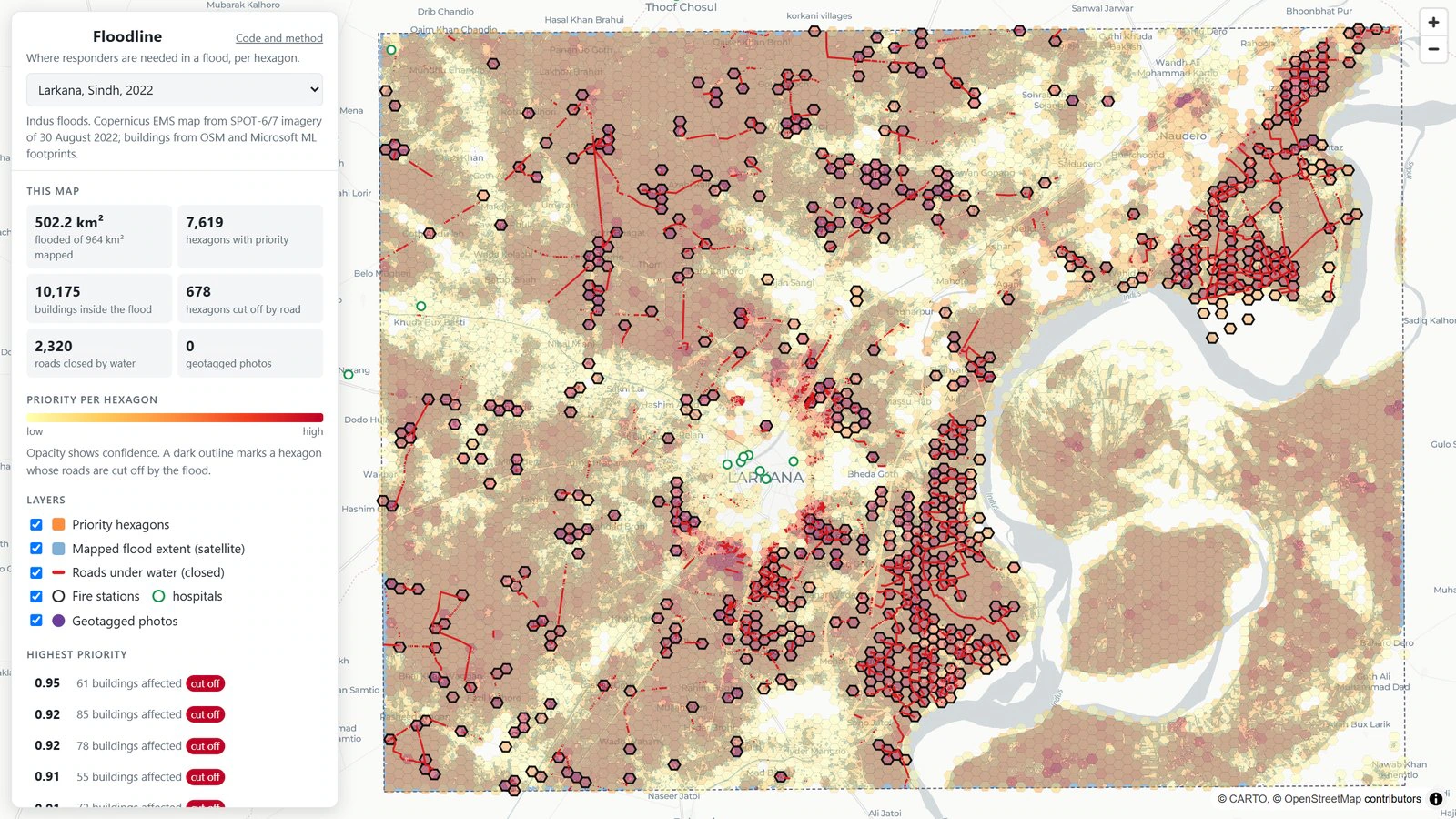
Geospatial pipeline in Python (GeoPandas, Shapely, H3, OSMnx/NetworkX, rasterio, DuckDB) that scores 0.1 km² hexagons from Copernicus EMS flood maps, building footprints, GHSL population and road access from fire stations and hospitals with flooded roads removed, so cut-off neighbourhoods show up.
Tested against analysts’ damage grades for six floods on four continents (3,806 damaged or destroyed buildings) with a spatial block bootstrap and leave-one-flood-out tests: the top 10% of hexagons hold 76% of the damage against 10% at random, and no flood drops it below 37%, while every single input layer falls to 10% or below on at least one.
Served as MapLibre GL maps of Prague, Dresden and Larkana, with an offline-first field app (TypeScript PWA, Supabase PostgreSQL with row-level security) whose single-use invites and server-issued device IDs keep colluding phones out of the top ten.
Next project
LineSentry
Industrial IoT · Dawlance